

High-Tech Data Solution for Hydropower Plants
Water reservoirs vary with snow cover and precipitation; multi-year averages can no longer predict snow stock and spring flow, and upstream maneuvers add uncertainty. Cerrus’ snow-water and hydrological forecasting platform is calibrated per basin with proprietary AI models and multi-source satellite fusion, operated under the Cerrus brand.
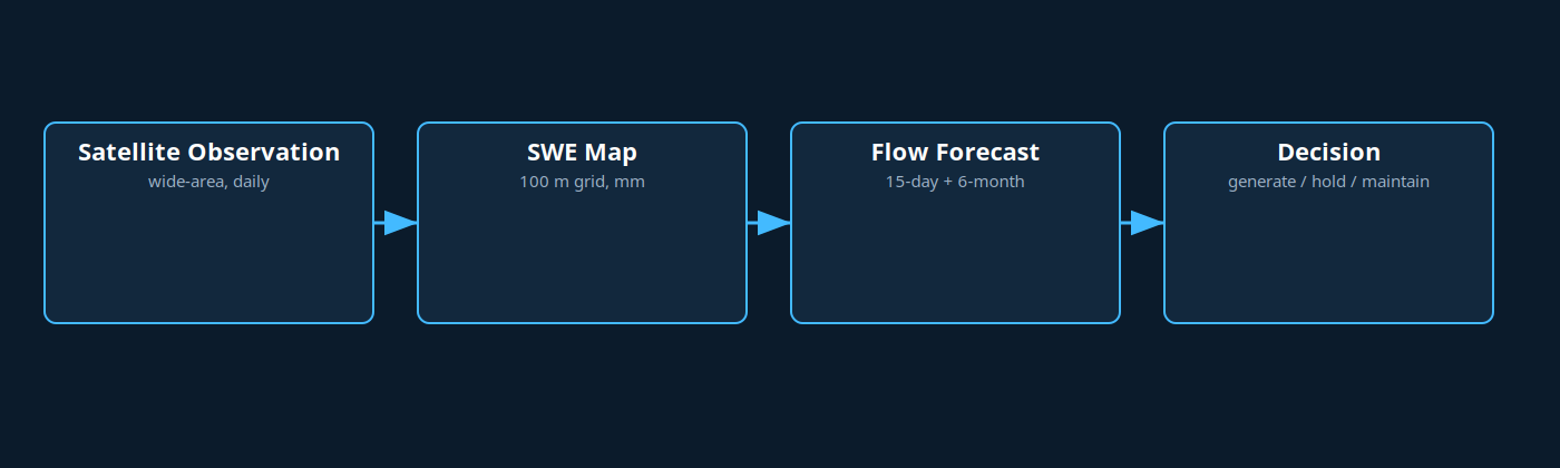
**How it works — four steps:** Satellite Observation (wide-area, daily multi-source) → SWE Map (per 100 m pixel, mm water equivalent) → Flow Forecast (15-day + 6-month probabilistic) → Decision (dashboard + API: generate / hold / maintain).
**What you get:** Historical SWE Archive (~10 years daily SWE) • Live SWE Flow (T-1 daily map) • Full Forecasting Platform (short + seasonal flow, KGE/NSE/RMSE reported). Setup: historical archive ~12 weeks, then live flow. Reference basin validation is anonymized.
Next step: share your basin polygon (KMZ/GeoJSON) and any historical flow data: hello@cerrus.io
Reference Basin Visuals
The visuals below are real products generated in an anonymized reference basin in Türkiye.
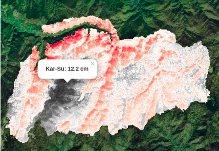
SWE distribution map — 100 m grid (navy ~21 mm → white ~207 mm).
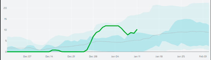
Daily SWE series: multi-year average and current year.
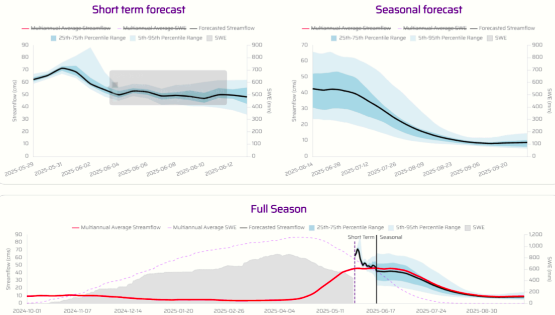
Flow projection: maintenance window and price-peak matching.